
Trace an Elk Grove Street Address
A useful street directory begins with one exact address, not a guessed list of names. Normalize the site address as USPS presents it, then search the Sacramento County Assessor by address or APN. The parcel viewer supplies the map anchor. From there, ownership must be obtained through a controlled county channel, and the recorded document index supplies the deed trail. Elk Grove city layers add permit and project evidence after incorporation. Historical occupants belong in reverse or telephone directories and census records, while voter information is available only through an approved geographic request.
Walk the address trail in order. Each step answers a narrower question and prevents an owner, occupant, voter, or past subscriber from being treated as the same person.
- Normalize the address. Enter the exact USPS-style street address in the Assessor Parcel Viewer and capture the APN and situs address.
- Map parcels one at a time. Pan along the street, identify the target, and click each touching parcel instead of assuming a block has one owner or one legal boundary.
- Use a controlled owner channel. Request parcel-specific ownership through the assessor lobby, a limited phone or email inquiry, or the public roll route.
- Read the deed chain. Use the Recorder index to connect grantor, grantee, recording year, document reference, and legal description, then match the seller to an earlier purchase.
- Add lawful context. Check city TRAKiT or GIS permits and projects, use only approved voter geographic data, and turn to reverse or telephone directories and census records for historical occupants.
The order matters. An APN narrows the parcel. A legal description confirms the land. A deed names title parties. A permit dates public work. A directory or census entry may place an occupant at an address in a particular period. The chain is strongest when those facts agree without pretending that one source is a complete household roll.
Elk Grove Parcel Viewer Fields
The county parcel viewer is the key search surface for address work. Its address field accepts a street location, while the APN field accepts the parcel identifier shown on parcel records and maps. Map navigation and the layers panel are not name-search tools, but they let a researcher inspect bordering parcels, assessment context, and related map information. The web result includes APN, situs, assessed values, tax-rate area, zoning or land-use data, and limited characteristics. Owner name is omitted online.
| Search field | Type | Required | Format or use |
|---|---|---|---|
| Address | Text or autocomplete | One search key | Use the normalized site address. |
| APN | Text | One search key | Use the hyphenated grouping shown on the parcel record or map. |
| Map navigation | Map controls | No | Pan, zoom, identify, and click parcels bordering the target. |
| Layers and legend | Panel | No | Read assessment map data; city layers add jurisdiction and planning context. |
The Sacramento County Assessor Parcel Viewer is free to use. Buttons vary in the embedded application, but search, clear or home, zoom, and identify are the core modes. Parcel lines are assessment aids, not legal boundaries, so a plat or recorded legal description remains the better land reference.
The parcel result can also show a Recorder book/page reference. That reference is a bridge to the deed index, not a deed image. Record the APN and situs before moving to the next source.
The parcel map shown here comes from the county assessor gateway. The official viewer source helps identify the map and its online owner-name limit.
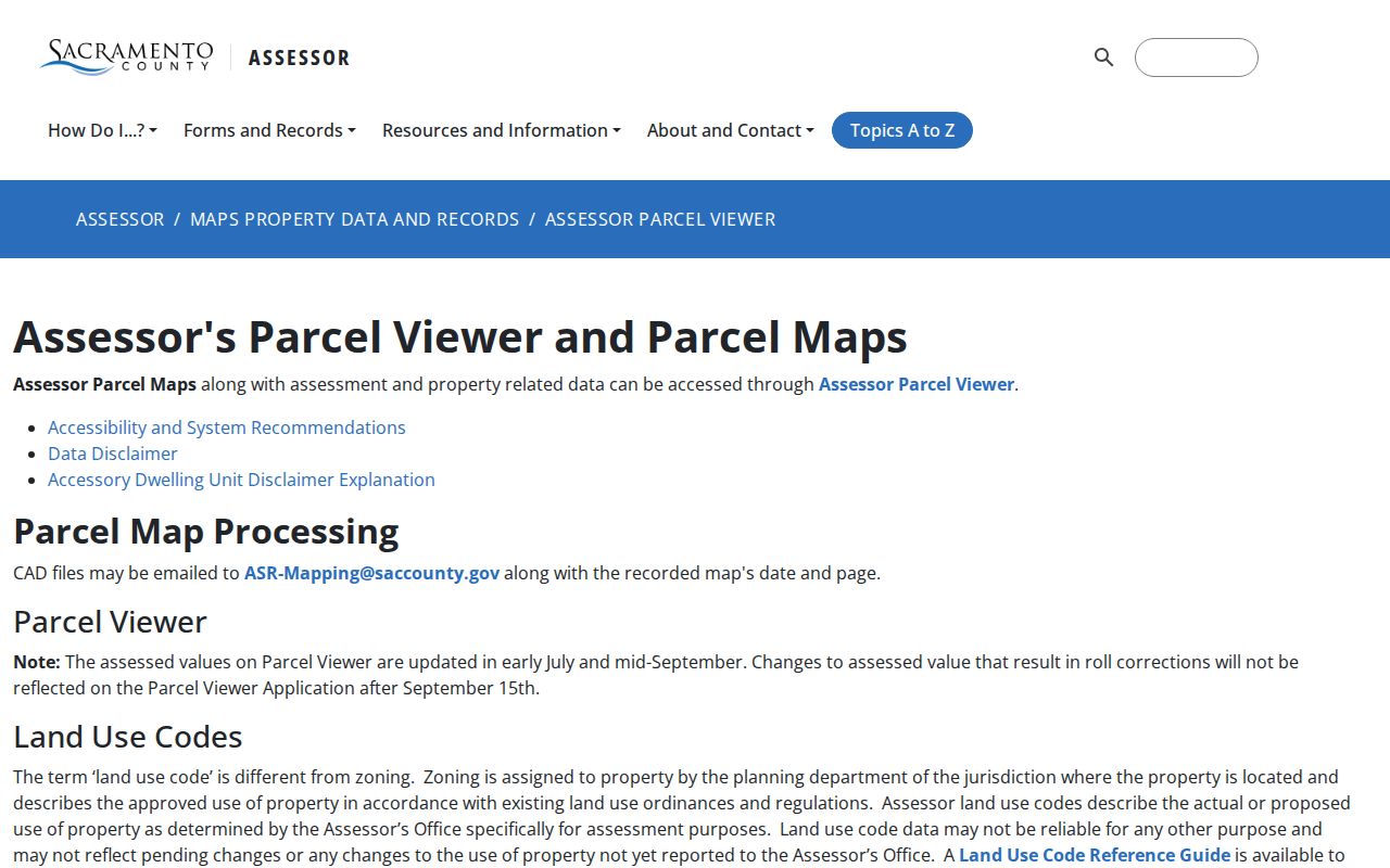
The image belongs beside the field table because the map is the first address key, while ownership remains a separate controlled step.
Elk Grove Street Records
Address-keyed records cover more than one kind of resident clue. The assessor supplies parcel and roll facts. The Recorder connects title parties. City GIS and permits add public projects and jurisdiction. A county voter file can supply approved geographic fields, but it is not a public by-street web list. Reverse directories and telephone books can place an historical subscriber at an address when a volume actually covered that part of Elk Grove.
| Address source | Street or block output | Actual limit |
|---|---|---|
| Assessor Parcel Viewer | Parcel shapes, APNs, values, situs | Owner hidden online; renters and household members absent |
| Assessor lobby or roll | Secured owner and mailing address | Controlled access; appraisal and exemption files remain confidential |
| Recorded Document Index | Parties to deeds, trusts, reconveyances, assignments, or liens | Index only; images require office viewing or copies |
| City permit and GIS layers | Work, projects, dates, status, districts, jurisdiction | Records begin unevenly; city map locations are approximate |
| Approved voter file | Registration fields by approved geography | Written purpose, ID, approval, and privacy rules apply |
| Reverse or telephone directory | Historical subscriber or listed occupant at an address | Coverage and years must be checked volume by volume |
A street directory is most useful when the output column stays attached to its limit. A deed party is not automatically an occupant. A permit site is not a roster. A mailing address is not a situs address. A reverse directory entry may reflect one subscriber rather than every person who shared the address.
For the recorded chain, the Sacramento Recorded Document Index covers documents since 1849 and searches by party name and recording year. It identifies deeds, deeds of trust, reconveyances, assignments, and liens, but it does not display instrument images.
Elk Grove GIS Block Walk
Map browsing is the street-by-street part of the work. Find the target APN, zoom until parcel outlines are clear, identify the target, and click each parcel that touches the street segment. Keep the street side, corner, and intersection in the notes. A radius or buffer can pull in parcels behind the target, so adjacency should be checked by shape and street position.
The Elk Grove City Information Gateway and GIS maps add parcels, boundaries, planning projects, districts, and other city layers. City disclaimers say map locations are approximate. The public TRAKiT building-permit layer caps a query response at 1,000 records, which makes address, date, and work-type filters important for a repeatable search. The city GIS is context, not a legal survey.
When an interactive map fails, Community Development can provide a printed map. The city lists 18 by 24 maps at $20 and 24 by 36 maps at $30, with normal preparation in two to three business days. The office is at 8401 Laguna Palms Way and lists 916-478-2265. A printed map can show the same planning context without changing the rule that parcel lines are not legal boundaries.
Elk Grove Ownership Channels
Sacramento County makes secured-roll ownership public through controlled channels while leaving owner name off the web parcel viewer. The lobby at 3636 American River Drive, Suite 200, has self-service computers and is open weekdays from 8 a.m. to 5 p.m. Assessor staff answer up to two parcel-specific ownership inquiries per day by phone at 916-875-0700 or by email at assessor@saccounty.gov. A free electronic roll or NextRequest route is also available. Have the APN or address ready.
That channel design is important for an Elk Grove street directory. It supports a known parcel inquiry, not a bulk owner-name sweep. Public roll fields can include owner, situs, mailing address, assessed and exemption values, tax-rate area, zoning or land-use code, Recorder book/page, map, and limited characteristics. Change-of-ownership statements, appraisal records, building footprints, and assessor-held permit details are not simply exposed with the online map.
The county's ownership guidance explains the difference between the public secured roll and the web result. The Assessor ownership information page is the source shown below.
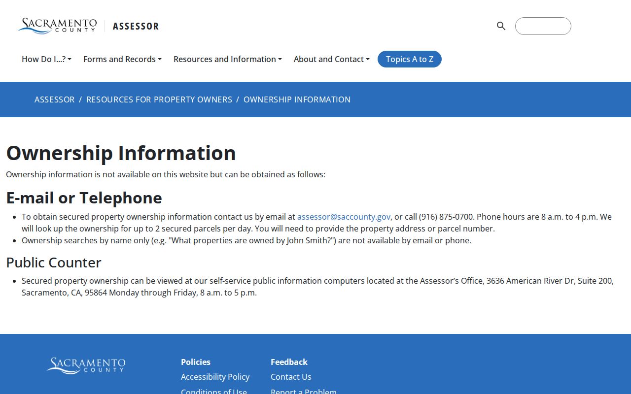
The screenshot belongs with the controlled-access discussion because the missing web owner field is a design limit, not evidence that no ownership record exists.
Insider tip. Bring two identified APNs to the assessor channel, since staff answer up to two parcel-specific ownership inquiries per day.
Elk Grove Deed Chain by Address
Once a parcel and current owner are anchored, move to the Clerk/Recorder. The 1849-present index asks for party name and recording year. A purchase deed names a grantor, the seller, and a grantee, the buyer. It also supplies recording data and a legal description. Search the grantor as a possible earlier grantee, then confirm the same land by legal description, subdivision, lot and block, parcel map, or APN. A shared surname is not enough.
The assessor records route shown below explains access beyond the map. The county assessor records page is a useful companion source for the parcel and roll side of the chain.
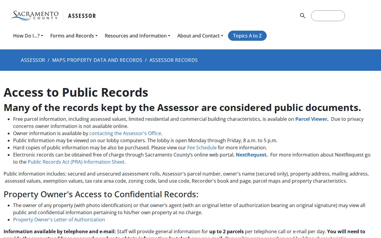
The image reinforces the handoff from an address fact to a custodian route. The Recorder index is free for identification, but no deed image appears online. The main Clerk/Recorder office at 3636 American River Drive, Suite 110, is open weekdays from 8 a.m. to 5 p.m. and lists 916-874-6334. The south service center at 8239 E Stockton Boulevard is open weekdays from 9 a.m. to 4 p.m.
The recorded-document search itself is available through the Sacramento Recorded Document Index. Its official capture is shown below.
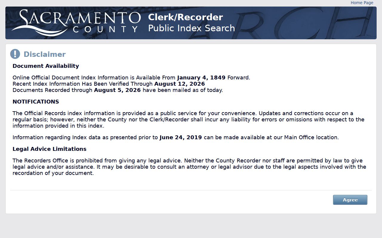
The index image belongs after the assessor handoff because it identifies parties and recording years, while the actual instrument still comes from the Clerk/Recorder.
Copies cost $8 for the first page and $1 for each later page, with $1 for certification. The copy supplies the legal description and named parties that a map cannot provide.
Elk Grove Permit Evidence
Elk Grove city permit evidence is address-keyed, but it is not a resident list. The public TRAKiT layer can expose permit number, site, work type, issue dates, and status. The response cap of 1,000 records means a broad street query can be incomplete unless it is narrowed by address, date, or type. Planning projects, encroachment permits, code records, and city GIS layers can add context about a parcel or corridor.
Plans and older attachments may not be in the public layer. The city Clerk's public-records route is the fallback for a focused request that names the address or APN, permit or case number, record type, and date range. CPRA asks for existing records. It does not require staff to create a street roster or answer a broad question with a new data set.
For a permit dated before incorporation, check Sacramento County as well. A present city address can have county files before 2000 and city files after 2000. That county-city seam is a core part of the Elk Grove street directory record trail.
Elk Grove Street Names Over Time
Older address work can fail when a road name changes. Lower Stockton Road became Franklin Boulevard. Main Street became Elk Grove Boulevard. Bond Road was extended east, and Laguna Boulevard developed west as a major corridor. Upper Stockton Road corresponds to the southbound Highway 99 alignment in the historical road discussion. A directory, deed, permit, and map may describe the same place with different names.
No verified wholesale street-renumbering year was located for Elk Grove. Do not invent one. Instead, search former and present road names, compare period maps, and hold the legal description or APN constant. Sacramento Room maps and the Elk Grove Sanborn sheets can show old street layout, while a deed can preserve the land description through the name change.
A road-name change is a reason to broaden a search, not a reason to merge two addresses without proof. Record the source spelling exactly, then place a normalized variant beside it.
Elk Grove Historical Street Directories
The historical side of a street directory depends on coverage. The Center for Sacramento History finding aid describes 196 volumes and 29 reels from 1850 to 2019. City directories span 1850 to 1990, telephone books 1967 to 2019, and reverse sections begin in 1914. Directory microfilm covers 1860 to 1936. The collection covers Sacramento and surrounding areas, but rural and suburban Elk Grove must be checked volume by volume.
A reverse entry can connect a street and address to a listed occupant or subscriber. A regular entry may add occupation, spouse, renter or owner mark, business address, and later telephone. It still represents the directory's scope, not every person in the house. The Sacramento Room and the Elk Grove Historical Society research library add yearbooks, newspapers, and local files that can fill gaps.
The full collection method belongs in the Elk Grove city directory collections reference. For current address-keyed work, keep the historical directory beside the APN and deed trail rather than using it as a substitute for either.
Elk Grove ZIP and Jurisdiction
The street-delivery ZIPs associated with Elk Grove are 95624 for older and eastern areas, 95757 for newer south and west growth, and 95758 for Laguna and central-west areas. ZIP 95759 is for post office boxes. Postal boundaries can extend past incorporated city lines, so an Elk Grove mailing city does not prove that a parcel lies inside the city.
Use USPS ZIP Code Lookup to verify the exact delivery address. Then compare the parcel with Elk Grove GIS and the county ZIP map. The 2003 Laguna West annexation added about 13,400 people and created a real jurisdiction record transition without requiring a postal label change. A permit question must be tied to the agency that held the address at the date of the work.
APN, situs, mailing ZIP, and legal description are separate keys. The Assessor does not assign street addresses. A mailing-address change request alters the tax correspondence field; it does not alter the situs or the recorded legal description.
Elk Grove Voter File Boundaries
There is no anonymous street-list button in the Sacramento County voter system. California My Voter Status is a personal, authenticated form. A county file requires a wet signature, current government photo ID, a written purpose under Elections Code section 2194, and approval. Permitted purposes include election, scholarly, journalistic, political, or governmental use. Commercial use is prohibited.
An approved file may contain name, residence or mailing address, party, precinct or district, status, registration date, and participation history within the requested geography. It does not show ballot choices. Driver-license data, Social Security numbers, signatures, and Safe at Home addresses are withheld. Specific-record requests require full name, date of birth, county, and present or former address, with a maximum of ten records per application.
Use the Sacramento County voter-file information and the application form for the current channel. A street directory that presents voter data as an unrestricted public roster would misstate both access and purpose.
Elk Grove Street Directory Limits
An Elk Grove street directory can connect a parcel, title party, permit, approved geographic record, and historical listing. It cannot prove that an owner lives at the situs, that a renter is listed, or that every household member appears in a directory. The parcel map is approximate for assessment work. The deed index has no images. City permits can begin after 2000. Historical directories may skip years or omit rural addresses.
Protected people may use California Safe at Home, and the program does not erase historic public records. Missing fields should therefore be treated as a possible privacy boundary. When the goal changes from a whole street to one person, the Elk Grove resident lookup workflow keeps name, court, vital, license, and address evidence separate.
- Parcel
- An assessment unit identified by an APN and shown on a map. It is not automatically the same as a legal boundary.
- Situs address
- The physical property address tied to the parcel, distinct from an owner's mailing address.
- Plat
- A recorded map or subdivision reference that helps connect lots, blocks, roads, and legal descriptions.
- Criss-cross directory
- A street or address section in a historical directory that can lead from a place to a listed subscriber or occupant.
Lawful personal use. Use Elk Grove address and voter records for lawful personal research. California Penal Code section 646.9 addresses stalking, and records must never be used to stalk, harass, threaten, or intimidate a person.